M5Stack Mini GPS/BDS Unit
Product Link
Description
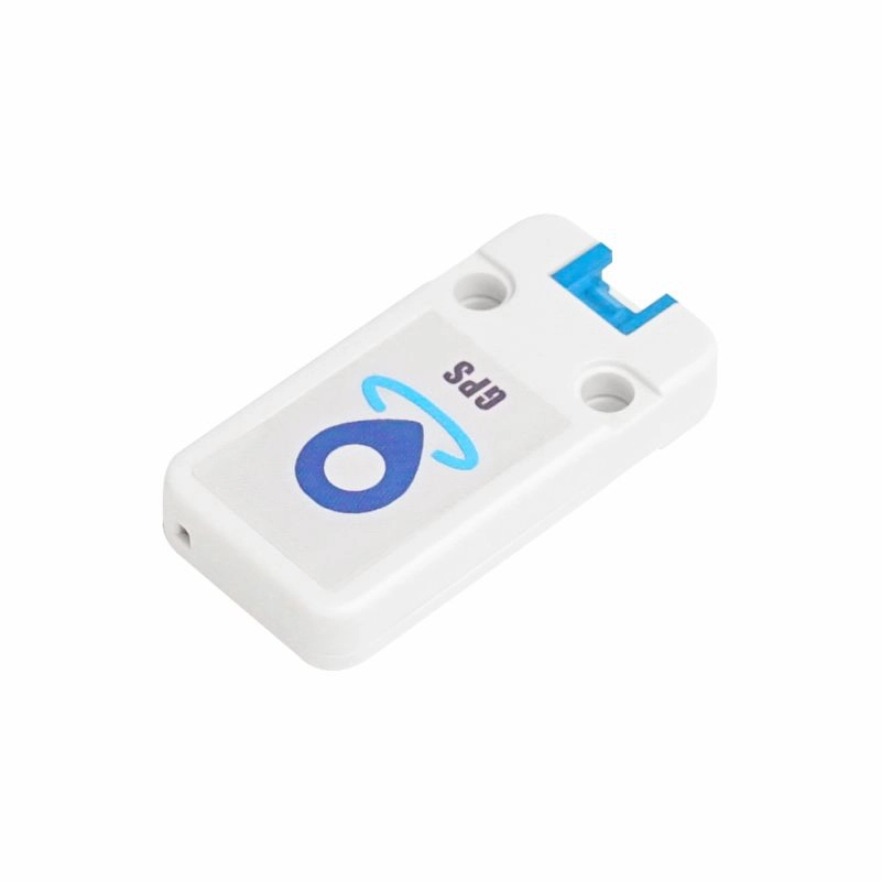
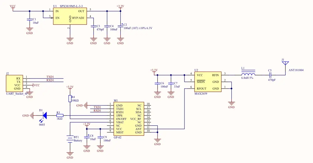
GPS is an M5Stack Unit that integrates a AT6558 navigation chip and a MAX2659 amplification chip which is used for amplifying the antenna signal.
AT6558 is an high performance chip that supports many types of satellite navigation systems, able to receive satellite signals on 56 channels GNSS signal from 6 satellite navigation system, joint location, navigation, timing and more.
The module is able to obtain accurate global location information, quick and accurate positioning for anywhere in the city, in the canyon, under the overhead and inside the car.
The module can be widely used in vehicle monitoring, bus reporting, car navigation, onboard navigation, notebook navigation and other products.
You can plug it into port C on M5core via GROVE cable, which is a standard UART interface.
UART settings :
Baudrate(default: 9600bps)
Start bits(1 bit)
Stop bits(1 bit)
Parity(no)
Features
Support single system positioning of BDS/GPS satellite navigation systems, or multi-system joint positioning in any combination
Support D-GNSS differential positioning
Two Lego-compatible holes
Applications
Vehicle positioning and navigation
Smart law enforcement positioning
Specification
Positioning accuracy
2.5m
Channel
56
Positioning update frequency
1-10Hz
Maximum speed
515m/s
Maximum acceleration
<= 4g
Sensitivity
Tracking: -162dBm,Capture: -148dBm,Cold start: -146dBm
Start Time
Cold start: 35 seconds,Warm start: 32 seconds,Hot start: 1 second
Operating temperature
-40°C - 85°C
Net weight
13g
Gross weight
26g
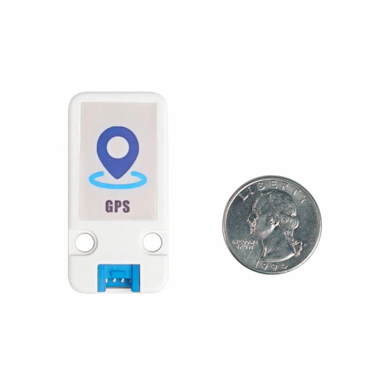
Product Size
48*24*8mm
Package Size
136 * 92 * 13mm
EasyLoader
What is EasyLoader?1.EasyLoader is a simple and fast program burner. Every product page in EasyLoader provides a product-related case program. It can be burned to the master through simple steps, and a series of function verification can be performed. .
After downloading the software, double-click to run the application, connect the M5 device to the computer through the data cable, select the port parameters, click "Burn" to start burning. (For M5StickC burning, please Set the baud rate to 750000 or 115200)
Pinout
GPS Unit
Signal Transmitter(TXD)
Signal Receiver(RXD)
5V
GND
GPS Unit
Signal Transmitter (TXD)
Signal Receiver (RXD)
5V
GND
Schematic
Related Links
Example
Arduino
To get the complete code, please click here
UIFlow
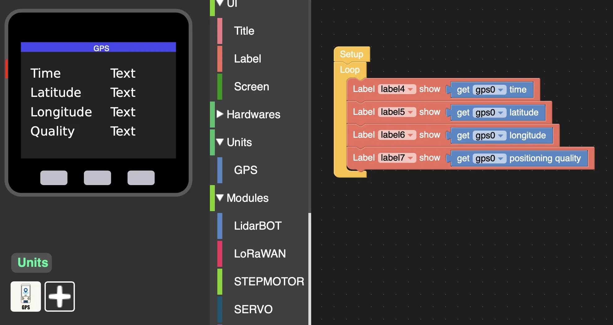
Feature Introduction
Get GPS information
get time Get local time
get latitude Get latitude
get longitude Get longitude
get satellite num Number of satellites acquired
get positioning quality Get positioning quality
get speed Obtain relative ground speed
get course Get geographic north pole location
set time zone Set local time zone
Usage
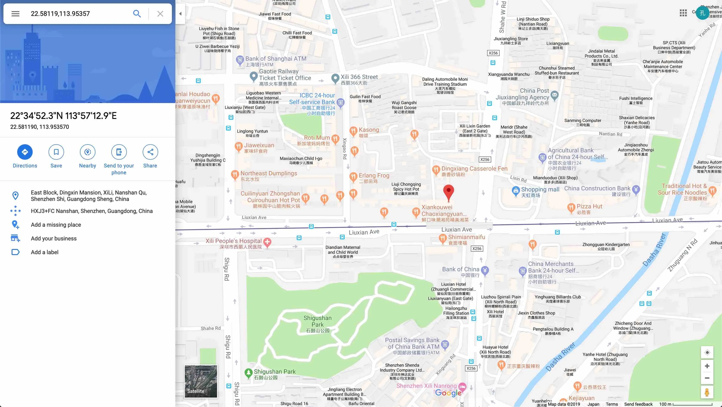
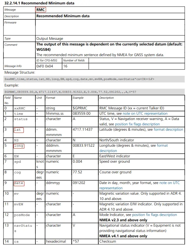
Analysis:
$GNRMC,063012.000,A,2258.11953,N,11395.35722,E,0.69,171.74,240419,,,A*7A
Indicates that the positioning information is UTC time is 06:30:12, north latitude 22.58119°, east longitude 113.95357°, date is April 24, 2019
Last updated
Was this helpful?